Railway bridge / engineering landmark
Royal Albert Bridge
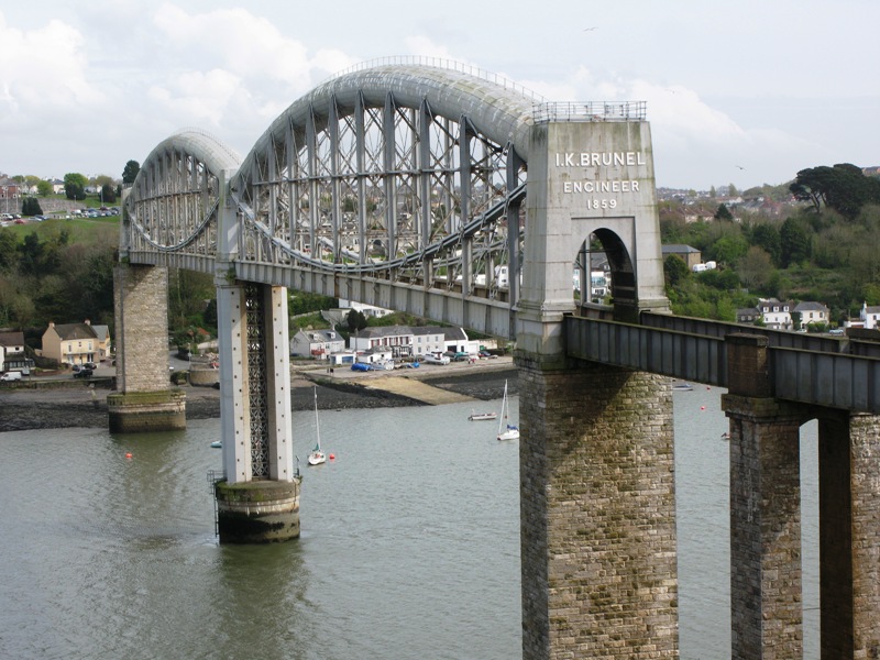
Designed by the celebrated engineer Isambard Kingdom Brunel, the Royal Albert Bridge carries the main railway line across the River Tamar between Saltash and Plymouth, marking the historic boundary between Devon and Cornwall. Surveying for the crossing began in 1848, but construction did not start until 1854 due to funding difficulties for the Cornwall Railway. The bridge's distinctive design uses two 455-foot lenticular (curved, lens-shaped) wrought-iron trusses, each acting like a bowstring, combined with suspension chains, resting on a central pier sunk into the riverbed using a pioneering pneumatic caisson method. The bridge stands 100 feet above the water to allow Royal Navy ships to pass beneath. It was formally opened by Prince Albert, Queen Victoria's consort, on 2 May 1859, and bears the inscription 'I.K. BRUNEL ENGINEER 1859' at each end. Brunel himself was too ill to attend the opening ceremony and died later that year, making it one of his final and most celebrated works. The bridge remains in continuous use today for the Great Western main line and is a Grade I listed structure and scheduled monument, regarded as one of the finest surviving examples of Victorian railway engineering.
See it on the visitor guide